


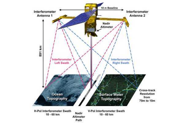
Dubbed SWOT (Surface Water and Ocean Topography), the international satellite launched from Vandenberg in California on December 16. It is the first to measure all the water on earth, both on land and in the oceans, and will do so every 21 days.
SWOT will use a radar called KaRIn, which is capable of conduct research on at least 90% of the Earth's surface. This equipment will be used to measure and monitor changes in the ocean, lakes, reservoirs, rivers and wetlands.
The goal, says the UK Space Agency, is to obtain data that will help improve our understanding of climate change, as well as predicting and mitigating flood risks around the world.
Source: electronicsweekly.com